HOME: COUNTRY MAP:COSTA RICA NATIONAL PARKS: CHIRRIPO NATIONAL PARK   Recommend this site
to a friend!
ESPAÑOL

Chirripó National Park

   
Size: 50,150 hectares.
Distance from San José: 
165 kilometers.
Camping: Permitted.
Trails: Yes.
Dry season:
December through March.
This lake is one of the greatest variety of waterflow, amphibians and reptiles.
   

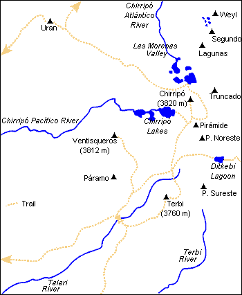
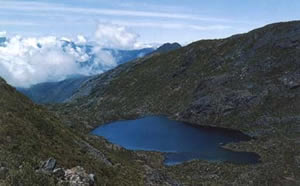
Chirripó National Park, which boasts the highest peak in Costa Rica at 3.820 meters above sea level, is located near the town of San Isidro de General about 60 miles southeast of San Jose. The main route into the park is located northeast of the town of San Gerardo de Rivas.


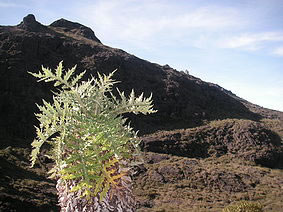
The upper reaches of the park, often cold and almost always cloaked in mist, contain the northernmost example of the "paramo" life zone, which is typical of high-elevation plains much farther south. The park also contains extensive areas of lower montane and montane rain forest and offers excellent opportunities for wildlife observation and nature photography. Coyotes, jaguars, other felines, squirrels, rabbits, frogs, bird's owls and quetzals are the most common species found.

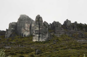
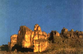
Chirripó is also one of the few areas suitable for technical rock climbing.

   
This lake is one of the greatest variety of waterflow, amphibians and reptiles.

The park experiences wide temperature variation. It can be as warm as 24 degrees C during the day and then drop to freezing at night. The altitude change between sea level and the high country is severe enough to give some people altitude sickness, particularly if they've spent a week or two in a dugout canoe or lying on the beach. It is best to plan a trip here after having spent at least a week hiking at a mid-elevation place such as Rincon de la Vieja or Monteverde to begin the process of acclimatization.

   
Costa Rica
 
Map of Costa Rica and its National Parks